Tuesday, August 30, 2011

A Visit to the D Day Memorial

During my week between jobs, Dad and I spent some time watching the weather and planning an overnight ride for the weekend. Unfortunitly our plans were changed a bit after Dad was scheduled to attend a meeting for work on that Saturday. With that in mind we changed our plans to get a good day ride in.

Saturday night before the ride Dad came up with a good idea for a ride which involved heading up to Bedford, Virigina to see the D-Day Memorial. Dad said that he and Mom and been to the memorial before, but if I had any interest he would love to go again. Well, being the history nerd I am... I was up for it!

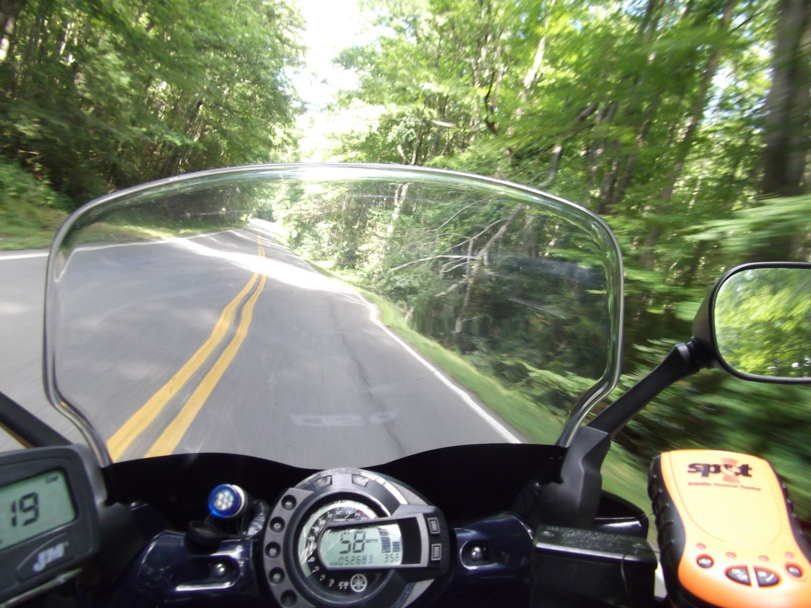
Before we left it looked like there was a good chance that we would get wet due to a front that was moving through from the west. Our best bet looked to be to the north and potentially miss it and come back down behind it. So with that in mind we headed up Hwy 52 to Hwy 8 like I did earlier in the week. I enjoy that road so much I am pretty sure I could ride it everyday and not get tired of it...


Rolling up Hwy 8 just shy of Danbury, NC. We got in line with a group of bikes including this trike... surprisingly he was doing pretty well in the corners.


In order to get over to Bedford from Hwy 8 we needed to take SR-40 across to SR-122 into Bedford. Now the last time I was on SR-40 was a couple years ago in the spring. The road was covered in so much gravel and dirt that it was no fun at all to ride. I even have video of that run and I happened to recording at such an angle that you can see the back tire slide as I run across some rocks in the road. So needless to say I was a bit nervous to head back that way again. Fortunitly for us the state had been hard at work cleaning that road up and had even repaved sections of it! The road was in amazing shape and was a joy to ride again!


At this point I can't remember if we had made it to 122 yet or if we were still on 40, but it was getting close to lunch time and we just happened to come across a Dairy Queen... To make Mike Brown happy, we decided to pull off there and grab a quick lunch before heading on into Bedford. I suppose his Goldwing has been rubbing off on the FJR and the FZ6.


Once we got into the Bedford, we made our way into the welcome center to purchase tickets for the memorial. On our way out the door we noticed that some dark clouds had started to move in and on our way up to the memorial the rain began to fall. We managed to get off the bikes and into the gift shop before the bottom fell out. Once that cell had passed through, Dad and I headed out and began walking around the memorial.


They had set this up so that the beginning of the memorial explain edthe events that led up to invansion by displaying statues and plaques that gave biographies on some of the key leaders in the D-Day invasion. The center peiece of the memorial were the statues and mock up of the Normandy beach. Around this area were all the names of the American soilders that lost their lives during the invansion. Finally the memorial came to a close as you passed down a row of trees that led to various other statues of political figures and leaders of the era following D-Day.


Kinda expected Patton to have a statue, not a plaque...


An amazing speech, one that would be difficult to give knowing that it was a going to be a slaughter..


Memorial was set up to give you the perspective of the solider as you were exiting the landing crafts and storming the beaches.


The water tank had small air cannons under water that were set on timers to go off to mimic bullets hitting the water.


Soldiers scaling the cliffs of Normandy.

About the time Dad and I started to make our way into the main part of the memorial, the next band of showers made their way in. We quickly headed for shelter inside the girft shop again and waited till it moved through. At this point the temperatures had dropped a good bit, so Dad and I sat out on the porch under the awning and discussed the battle and such.

The storm didn't hang around long, the sun came back out as did the blue skies. We headed back out to the center of the memorial to read some more plaques and take everything in.

Soldier making it over the top of the cliffs at Normady. Amazing back drop with the mountain range...


The curved wall in the back ground contains plates which have the names of all the American soldiers who died during the invansion.


Statue set up towards the end of the memorial. The soldier that is on his feet is wearing a wedding band. It was the only part of the statue with any color to it. Very powerful peice...


Final monument of the memorial...


Once we had made our way though the memorial, I went back to the gift shop to pick up a shot glass to add to my collection. We looked over the map and set off looking for some back roads to make it back down to Martinsville, Virginia. An hour later we ended up just a few miles south of where we started and decided to head back the way we came... Barn I have been meaning to get a picture of for a while now. I will try and get a better shot next time with the mountains in the back ground.


We made it home around 7 or so that evening after riding a little over 300 miles. We stayed dry up until the last 15 miles of the ride... but I have no complaints. It was a great ride, one which I will never forget. The memorial was sobering and breath taking. Later that week the History Channel was running a documentary on the invansion... it truely is amaizing what those young men did.


Friday, August 26, 2011

Back Home - Time to Ride

I suppose I will start this one by updating everyone on a major event in my life. As most of you were aware, the past year I have been residing and working outside of Raleigh, North Carolina. However, around the first of July I received a phone call from Scott Janus, the engineering manager at TurboCare of Winston-Salem, the company I interned with during the summer of 2009. They had a couple guys move around within the company and a position had become available. In an attempt to get someone in who had some experience with company, they contacted me to see if I would be interested. Long story made short, I received an offer from TurboCare that I couldn’t refuse, turned in my notice at Natvar and my first day at TurboCare was August 22nd. So with that I have left Raleigh and I have moved back home with Mom and Dad for a while and I am starting over again…

My last day at Natvar was August 12th, so that left me with a week off before I started work at TurboCare. I was able to get everything moved in and settled by Monday following my last day at Natvar, so with that I decided to go for a little ride.

My old roommate, Josh, happened to have the week off as well from his employer so we planned to get together and ride on Tuesday the 16th. He had mentioned something about riding up to Tuggle’s Gap and then if possible head over to Hwy 421, The Snake. Well, the most scenic and entertaining route to The Snake from Tuggles Gap was via the Blue Ridge Parkway. The only problem with this is that Boone is 125 miles down the parkway from Tuggle’s gap and the Blue Ridge Parkway is a very difficult road to make time on. However, if we got an early start, it looked as though doing a ride like that would be doable.

Tuesday morning I left the house around 7 am and headed to Josh’s new house in Thomasville. From there we headed across 109 to Hwy 52 and up to Hwy 8 just north of Winston-Salem. Out of all the semi-local roads in my area, I think I enjoy Hwy 8 between Winston and Woolwine, Virginia the most. It is such an amazing road with its awesome sweepers and amazing scenery.

After about an hour and half of riding we made it up the start of Tuggle’s Gap and were able to make a complete run without any traffic. We made it to the top of the gap and were pulling up onto the parkway in no time. From this point we had 125 miles of parkway riding to do before we would exit in Boone, NC. Judging by the time, it looked as though we could catch a semi-late lunch at Boone Drug if we pushed it a bit.

After a few miles on the parkway we made a quick stop to water the trees.. I happened to pull off at a rather nice over look, so I took the opportunity to take a few shots.


My favorite shot of the day. A little humor I suppose.

It was an absolutely beautiful day up on the BRP!

Josh and I passed the miles on the parkway quickly, pushing the speed a touch and enjoying the long sweepers that winded through the trees of the Appalachian mountains . We were making good time until we came up on a section of the parkway which was closed around Hwy 21. The detour signs led us north on 21 until it intersected with Hwy 18 south which led us back onto the parkway next to Stations Inn. We lost a little bit of time by taking this detour, but there wasn’t anything we could really do about it. So we carried on and continued to work our way south until we reached Boone.

About an hour later we reached the intersection on 421 just outside of Boone, so we pulled off and headed into town to grab a Parsons Burger and some fries. Boone Drug is a small drug store in down town Boone that still has a grill and ice cream bar in the back. It was first described to me as “the best greasy burger you’ll have in your life.” The description is spot on… they are amazing.

Josh and I spent about an hour there at the drug store enjoying our lunch and talking about the recent events in our lives. Josh has recently purchased a new home and has proposed to his girl friend as well. So we discussed all that and the changes that occur once those responsibilities and obligations are put on your plate. I wish him and his fiancée, Heather, the best.

Back on the road we continued up Hwy 421 up through Mtn. City, Tennessee heading towards Shady Valley so that we could make a pass on one of our favorite roads, The Snake. On our way through Mtn. City we were stopped by some school traffic as the local elementary school was dismissing the busses for the day. At this point I started thinking about Shady Valley and wondering if we would meet any busses while making a pass on The Snake. Hwy 421 is one of the only ways up to that area.

Traffic remained “heavy” as we made our way up to the beginning of The Snake so we pulled off at the gravel lot and waited till the slower traffic had moved on. After a few moments passed I decided that we should probably go ahead and start our pass. We fired the bikes back and I as I looked over my left shoulder to check for traffic I noticed a large yellow school bus was rounding the corner and heading our way. Time to go!

As we made our way up 421 it was apparent that the state had been cutting away the rock on the side of the road for drainage and visibility purposes. This was great, however the workers had drug some dirt on the inside of north bound lane. Seeing as how dirt and rocks can cause problems for street bikes in the corners, I decided to hold back a bit in the event something was in the middle of a blind corner. The road work stopped about half way up the pass and the road was in great shape from there on out. I stopped for a moment as I rounded the left hairpin that overlooks the Valley that I have come to enjoy so much.

Once at the store we pulled over to chat about the pass we just made and after a few minutes that bus had made its way down to the store. Apparently the country store doubles as a bus stop as well because the parking lot was full of parents waiting to pick up their children.

This thing still amuses me... Glad I got to see it run on one of my visits.

I've started taking photos while riding with my small camera. Makes for some neat shots I think.

Rolling up to The World's Shortest Tunnel. Think you can hold your breath through it?

Cornering is fun with a camera in hand.

One of the many reasons I love Hwy 58 through VA.

Cool old farm in the VA country side.

Sketchy old house..

Amazing

Once the bus departed we headed east on 133 towards Damascus and the world’s shortest tunnel. From there we carried on to 58 east which is always a pleasure. After putting the bikes through the paces on 58 through Mouth of Wilson we headed south on 93 and onto 21 south. Since my last visit to that side of Hwy 58, the state had paved a good stretch of it and the asphalt was perfect! This was a huge improvement over the gravel and debris that had littered the road surface during my last visit.

From 21 we continued down to Hwy 421 East to Hwy 52 and back home. My trip meter was boasting 455 miles for the day; however, Google maps confirmed that the route was 435 miles…


The Route!